

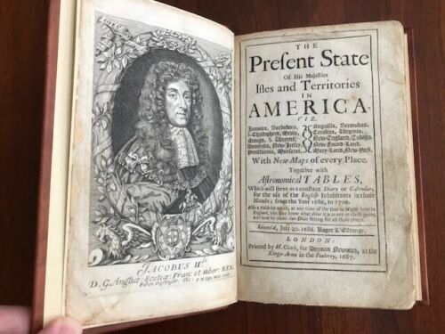
The Present State of His Majesties Isles and Territories in America, viz. Jamaica, Barbadoes, S. Christophers, Nevis, Antego, S. Vincent, Dominica, New-Jersey, Pensilvania, Monserat, Anguilla, Bermudas, Carolina, Virginia, New-England, Tobago, New-Found-Land, Mary-Land, New-York. With New Maps of every Place. Together with Astronomical Tables.
London: Printed by H. Clark, for Dorman Newman, 1687. First Edition, First Printing. Full leather. 4 ¾ X 7 ¾ Inches. 262 PP + Appendix. Good +.
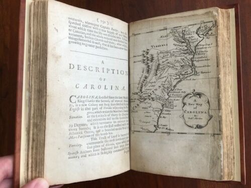
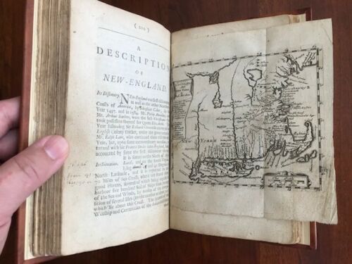
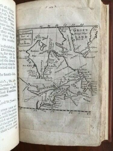
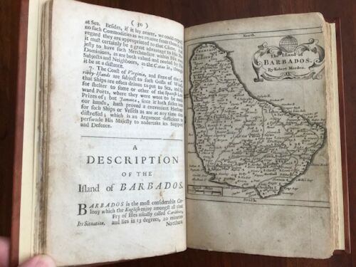
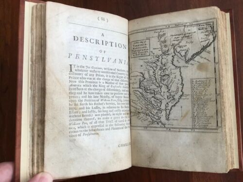
First Edition, First Printing copy of Blome's description of British possessions in the Americas. "A popular but unreliable guide which did much to attract emigration to these shores." (HOWES) Engraved frontis portratit of James II and six maps (A New Map of Virginia, Maryland, Pensilvania, New Yarsey - The Island of Barbados - The North West Part of America - Estivarum Insulae at Barmudas - A New Map of Carolina - New England and New York). All maps by Robert Morden. The North West Part of America map torn at page edge. A New Map of Carolina bear minor tissue repair at edge.. Missing the large folding map of Jamaica. Includes the engraved plate for setting sundials and all publisher advertisements.
Rebound in classic "two-toned" genuine calf leather with elaborate stamping in blind to covers. Gold gilt title, date and decoration to spine. Five raised hubs. Foxing throughout. A few stains. Pages remain extremely fresh. Possibly an editorial copy with extensive notes in a period hand on position of maps and corrections to text. The writing appears to extend further than simple reader reaction and would appear to be the sort of work done in an early "working" copy of the text.
Overall, a nice copy that has been rebound in a splendid leather binding with all pages, maps and plates save one (the map of Jamaica). Missing one of the seven maps. Rebound in recent fine leather binding. Tissue repair to edges of a few interior pages. Foxing and a few stains. Item #100044
Price: $7,500.00